When my friend called to see if I wanted to head out on an overnight hike on Mt Ruapehu, my first reaction was, “absolutely”, followed closely by “what if the skiing is good that day?” The issue with hiking in an alpine environment, is that you really want a clear weather day, which is also what you need for a great day skiing.
So as the mountain enjoyed the last of the spring skiing, we managed to head off for a couple of overnight hikes in the surrounding trails and would thoroughly recommend them both.
Both overnight huts were on the Round the Mountain Track, which is as it sounds, a track that circumnavigates Mt Ruapehu. You can walk the track in either direction and to do the whole track, (66.2km loop) which takes between 4 – 6 days, with 6 huts to choose from and various campsites available or you can choose to do part of the track with access points from Whakapapa Village, and off the road to Tukino and Turoa. You can also access the Round the Mountain Track from a few feeder trails off the State highway 1, Highway 47 and from Horopito.

Hike one: Mangaehuehu Hut
Two days, one night
9km one way – approximately 6 hours return
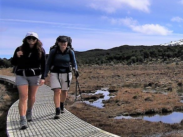
This hut is best accessed from the Ohakune Mountain Road, at the 11km mark, with parking available at the track entrance. The sign indicated that it was just under 9km to the hut and the for the first few kilometres you follow a well maintained track through the bush. Within minutes you cross the first of many bridges before gently climbing out of the bush onto an impressive boardwalk that meanders through the wetlands. From here, on a clear day, you can see the lifts of Turoa. The trail then heads back into the beech forest and down to Waitonga Falls.
The 39m falls are the highest in the Tongariro National Park and if you only have a few hours it’s worth the walk just to this point and back again.
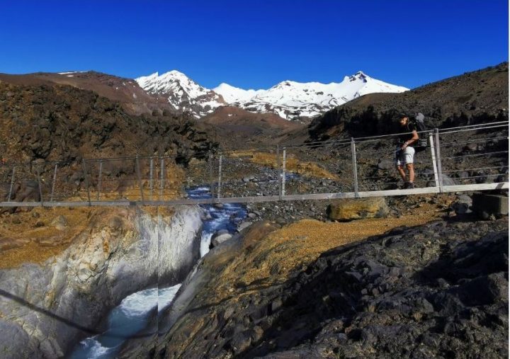
After the falls, the track becomes a little more rustic and is littered with swing bridges and the occasional river crossing. Although the river had a steady flow when we were there due to the spring melt, (we could cross without getting our feet wet), you needed to keep a look out for the orange markers on the other side of the stream to know where the track went as this was not overly obvious at first glance.

The thing that really impressed me about this hike was the variety. We passed through dense beech forest, open wetlands, numerous rivers, waterfalls, rocky gully’s and stunted trees like something from a Dr Seuss book and finally to the open tussock fields that I was more familiar with in this area.
You can walk to Mangaehuehu Hut in 3 hours but allow yourself longer to enjoy the numerous scenic spots along the way. Mangaehuehu Hut is an 18 bunk serviced hut with incredible views over the surrounding area. Due to its elevation (1285m) and the fact that we had a clear day, you can see for miles. The hut is well established with a fantastic pot belly fireplace in the centre of the hut and large picture windows allowing excellent views in every direction, (a real bonus when the sky turned the most intense red and rewarded us with an incredible sunset).
If you wish to carry on further than the Mangaehuehu Hut, it’s another 5 ½ hours to the Rangipo Hut. We chose to stay put and head back the way we had come the following morning. Due to the time of year we saw very few people and were the only ones staying in the hut that night.
Hike two: Rangipo Hut with sidetrip to Whangaehu River and Waihianoa Valley
Two days, one night
Access to this section of the Round the Mountain Track is from Desert Road, via the Waihohonu Track (a full day hike) or from the 4WD access road to Tukino Ski Field. We took the latter, and have a new found respect for the local skiers, who drive this road to access the ski field.
This side of the mountain is in stark contrast to our first hike, the track for most of the way is sparce of vegetation and very exposed to the elements. According to DOC it is the only true desert landscape in the North Island, with features of vast plains of wind-swept sands and volcanic rock.
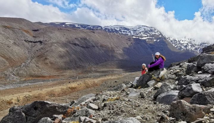
The first significant landmark, and challenging section of this part of the track is crossing the Whangaehu River lahar path, an area with great historical significance in New Zealand, being responsible for the 1953 Tangiwai Disaster. There are plenty of signs warning you that you are in the area and they are somewhat ominous. “Do not stop”… “Do not enter if you hear a loud roaring noise upstream.” It does make for a rather nervous crossing, not only does it come with some potential lahar danger, the terrain itself is also quite challenging, with large rocks and valleys to clamber over and under as well as a single person bridge in the middle. However, the scenery here is spectacular, particularly the view of the mountain on a clear day.
Although only 5km to the hut, the terrain is varied with lots of ups and downs. The trail is largely unformed but well-marked, mostly rocky with large tracks of fine scoria, making our poles invaluable.
Rangipo Hut is a serviced 20 bunk hut facing east and sitting at an altitude of 1556m. It’s perched on the southern edge of the desert looking out to the Kaimanawa Mountains and Desert Road. The positioning of this hut offers impressive sunrises on a clear morning, worth getting up early for, and a vast night sky. Reading the hut book, with tales of stormy nights and blizzard conditions, it reminded us that clear weather is not always a guarantee.
If you climb the rocky outcrop, directly behind the hut, the mountain will reveal itself.
Sidewalks: Waihianoa River Gorge. About 45 minute further on from the Rangipo Hut you come across the Waihianoa Gorge, one of the mountain’s largest valleys. It’s an impressive sight; it is steep (it drops nearly 200m in just over 300m and climbs another 150m) and the ground uneven to say the least. It’s bleak, exposed and somewhat intimidating and makes you realise the force of nature. It takes approximately an hour to cross what is referred to by some as “the Grand Canyon,” which upon seeing I can understand why.
One of the advantages of visiting as a day trip was that we did not need to cross as we were heading back at to the Rangipo Hut, so we were able to explore at our own comfort and appreciate the grandeur from up high.
In summary, the beauty of these two hikes was that we could access two very contrasting environments on Mt Ruapehu. We got to enjoy some of the highlights of the Round the Mountain track, within a short period of time. This also meant we were able to take advantage of a small weather window for each hike.
Extra info:
This is an alpine environment, so be prepared for sudden changes in weather.
If there has been recent rain, take extra care on the river crossings.
Mangaehuehu Hut: 18 bunks, great closed wood fireplace, longdrop. First come first served basis, one serviced hut ticket (adult $15) to be left at honesty box.
Give yourself enough time to explore the surrounding areas of the huts. There’s a river close to the Mangaehuehu Hut that makes for a great spot to wash down in or simply to explore.
words and images by Lynne Dickinson and Vicki Knell


